Converting a regular carto project to vector tiles
OSM-carto case study
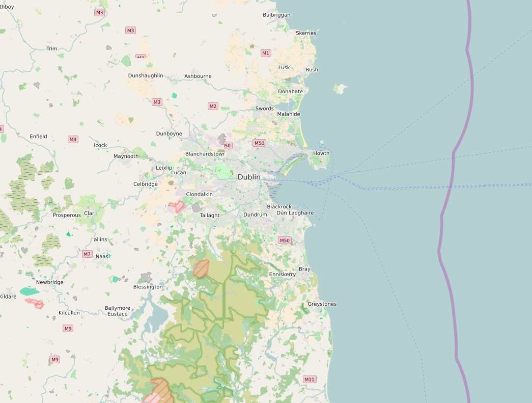
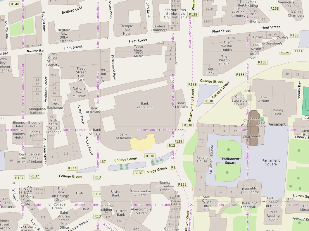
Rory McCann www.technomancy.org
Geofabrik geofabrik.de
OpenStreetMap Carto style
- Main main on openstreetmap.org
- Style has been grown for years
- Ported to CartoCSS by Andy Allen in 2012
- Probably one of the most complicated CartoCSS styles
Goal
Same output (raster images over HTTP), but served behind with vector tiles
Not client side JS / Open GL rendering
To allow one to make minor tweaks to the style without having to host a whole new style
Let's go!
How do we render it?
Kosmtik can render a vector tiles project into images-over-HTTP
tilelive - collection of libraries for rendering & serving tiles
tessera - command line tilelive-based tool for serving tiles.
Split the project into two
OSM-carto is just one project with a project.yaml
Vector tiles are 2 projects, source and style
osm-carto.tm2 and osm-carto.tm2source
Source project - osm-carto.tm2source
One data.yml (NB: .yml not .yaml)
Remove the top level source and styles keys
Set maxzoom: 14
Style project - osm-carto.tm2
One project.yml (NB: .yml not .yaml)
All .mss style files.
source is URLish to you tm2source project
All Layers only have the id
Done?
ha!
sadface
Results
Results
No carto classes - ergo no roads

No carto classes
You can't use carto classes - only ids - to filter
Rewrite style to only use #id instead of .class filters
Not so bad for osm-carto
Lots of classes map 1:1 to layer ids anyway
Solved!
Buffer
Common problem in vector tiles
Each vector tile data has a clipped polygon/line for each object
Can only see data inside your tile
Except sometimes you need to see outside your tile
Or you can't render properly
Buffer
Buffer
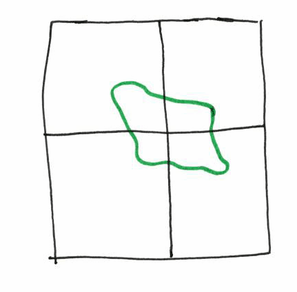
It's a polygon (green). We want to draw a border.
It is spread across many vtiles (black)
Buffer
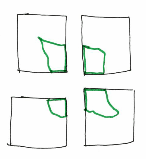
Polygon is cut. 4 new polygons
Buffer
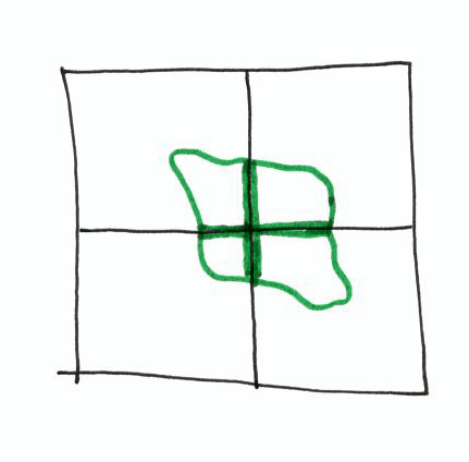
Border of the polygon is rendered at tile borders
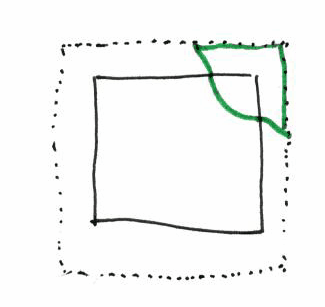
Solution - buffer-size
Add buffer-size: $PIXELS to each data layer properties
Value can be small (~4) for polygon boundaries
Large (~128) for label placement
Solution - buffer-size
Polygon now goes outside the image, border still draw.
But results are clipped out of final image
Problem: Centroid of a polygon
e.g. Labels for names, addresses, icons.
In raster tiles, using meta tiles, mapnik has the polygon, and can place the centroid once
Vector tiles: Each tile is separate render, each tile has its own polygon
Problem: Each tile will have a label in the middle
Solution: Change SQL to return a point, not a polygon
i.e. Have PostgreSQL, not Mapnik, convert the polygon to a point
You now have a point layer, and mapnik puts the label there
Only one point per polygon, regardless of how many v. tiles the polygon is on
SQL
ST_Centroid(way) AS way: Geometic centroid
ST_PointOnSurface(way) AS way: Point will be inside polygon
Centroid is about 4 times faster, but PointOnSurface is more "correct"
Problem: Indexes
"Give me buildings in this bbox" → PostgreSQL can use geom index
"Give me ST_Centroid(way) in this bbox" → PostgreSQL cannot use index
Solution: Use an Index
Add AND way && !bbox! to WHERE clauses
Makes PostgreSQL filter based on the way column, and use the geom index
Or you can CREATE INDEX on ST_Centroid(way)
Zoom level
Data is being simplified
Fine for normal zoom level, but z15+ uses z14 data
Simplification is too much
Solution - maxzoom
maxzoom: 14 in tm2source
mapnik won't do simplication for z14 tiles
Initially I tried to use symlinks as a hack to vector-tile-ify this and use the same project.yaml for both the source & style
But source and style need different maxzoom.
Source needs maxzoom: 14 to prevent simplification
Style with maxzoom: 14 means no z15+ tiles
All data needs to be at z14
Each layer in the source has a minzoom
Needs to be minimum of 14
Otherwise data won't be included in z14 tile, which is uses to render z15+ tiles
Style can still filter on zoom for display purposes ([zoom>16])
Minor: way polygon type on planet_osm_polygon
With default osm2pgsql database, node-mapnik will do something strange and silly
Tries to autodetect geometry type by running the query and looking at first few rows
No bbox filtering, runs query globally
SELECT all buildings ORDER BY way_area DESC LIMIT 5
This is slow
Solution - Change geometry type
ALTER TABLE planet_osm_polygon ALTER COLUMN way TYPE geometry(MultiPolygon, 900913) USING ST_Multi(way);
Have a osm2pgsql fork which imports as MULITPOLYGON
Code has been released on GitHub
Will try to keep it updated with upstream style (no guarantees)