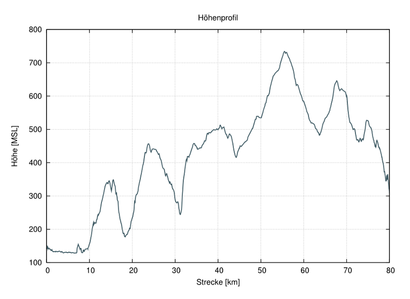
For a client from the outdoor sector, we have implemented a service that extracts terrain height information.
The service has a JSON interface and can therefore be used flexibly from various applications. It is based on the free SRTM dataset from NASA. In order to be able to compute height information even for locations between the SRTM grid points, the algorithm looks at the four nearest grid points and computes an interpolated result.