
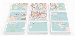
Whether it's raster or vector tiles, both technologies divide up the world into small rectangles on different zoom levels. Raster tiles contain PNG graphics, and vector tiles contain data packages.
Pre-generated tile packages are an alternative to tile servers if users do not have internet access, if using an external tile server is undesirable, and running a local tile server is too cumbersome. They contain all tiles in a region for a range of zoom levels. The packages can be either stored on a mobile device for offline usage, or extracted onto an intranet server and made available to users. This is possible for raster and vector tiles alike.
Theoretically, you can download the required tiles from the tile servers of the OpenStreetMap project. However bulk downloading is prohibited by OSM's tile usage policy because it puts too much load on those volunteer-run services.
In addition to raster tile and vector tile servers as a service, Geofabrik offers pre-generated tile packages. They can be provided as ZIP archives, MBTiles files or individual PNG tiles on an external hard disk drive. On request, other map styles or data schemas than those available for our hosted servers can be used. Please get in touch if you are interested.
Tile packages can become quite large on disk. At the lowest scale, zoom level 0, the map of the whole world fits into a single PNG image of 256x256 pixel. For any additional zoom level, the tile is divided into four tiles. This means there are two tiles along the x axis and two tiles along the y axis on zoom level 1, i.e. four tiles in total. This continues for each zoom level.
| Zoom level | Number of tiles on this zoom level |
|---|---|
| 0 | 1 |
| 1 | 4 |
| 2 | 16 |
| 3 | 64 |
| 4 | 256 |
| … | … |
| 18 | 68.7 billion |
The size of tile packages grows similarly with each additional zoom level. The following table shows a few examples for raster tiles. You can do your own estimates using the Tile Calculator:
| Germany | Europe | USA without Alaska and Hawaii | ||||
|---|---|---|---|---|---|---|
| Zoom levels | #Tiles | Size | #Tiles | Size | #Tiles | Size |
| 0–6 | 9 | < 1 MB | 182 | 1.1 MB | 84 | < 1 MB |
| 0–10 | 1420 | 44 MB | 52,000 | 421 MB | 21,000 | 142 MB |
| 0–12 | 21,000 | 408 MB | 819,000 | 3.6 GB | 329,000 | 1.3 GB |
| 0–14 | 336,000 | 4.1 GB | 13 m | 38 GB | 5.2 m | 17 GB |
| 0–16 | 5.4 m | 36 GB | 209 m | 415 GB | 84 m | 237 GB |
| 0–18 | 86 m | 313 GB | 3.3 bn | 5.6 TB | 1.3 bn | 3.1 TB |
| Bounding box | 5.53°E 47.23°N 15.38°E 54.96°N | 23.82°W 34.54°N 46.84°E 71.46°N | 125.42°W 24.12°N 66.45°W 49.43°N | |||
It's a little differnt for vector tiles because they are only ever created up to zoom 14; higher zooms are computed from the zoom 14 data. A world-wide vector tile package with a suitably simply data schema can be as small as 100 GB.
We're happy to make you an offer. For a ballpark estimate, a raster tile package based on a standard map style might cost EUR 300 for 100,000 tiles, EUR 500 for 1 million tiles, and EUR 700 for 10 million tiles.