
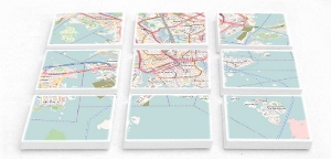
Similar to the widely used tiling schema for raster tiles, a standard for vector tiles has emerged. Geodata gets filtered, simplified, and then wrapped into small data packages, each covering the same area as a standard raster tile. Instead of a ready-made PNG image, a vector tile contains raw geodata, and it is only on the device (e.g. in the browser or a mobile app) that a map is drawn from this data. This reuquires more computing power, but resolution, direction, and styling of the map can be selected on the device. A map made from vector tiles could for example be rotated to match the direction of travel, or switched to dark mode for night use.
Geofabrik offers the use of their existing vector tile servers to customers. The customers only needs to host the map style, and referes to Geofabrik vector tile URLs from there. Client devices then load the vecotr tiles directly from Geofabrik servers.
Our clients receive an individual API key (32 long alphanumeric string) which is provided in the URL. Additional API keys can be provided on request if a client wants to distinguish different applications.
The Geofabrik vector tile servers use the Shortbread scheme. Only map styles developed for this schema can be used with the Geofabrik tile servers.
You are not limited to the Shortbread schema if you use a dedicated tile server which we set up and run for you (XXL plan). On request, we can add a different schema or develop a new one for you.
| Plan | maximum tiles per month | Price without VAT |
|---|---|---|
| Small | 100.000 | EUR 40 per month |
| Medium | 1.000.000 | EUR 80 per month |
| Large | 10.000.000 | EUR 160 per month |
| XXL | unlimited | starting at EUR 450 per month |
The fees are charged for one year in advance on signup.
XXL: If you believe that our monthly tile quotas aren't sufficient for your use case, then you can order a dedicated server. That way you have full control over how many tiles you download at which priorities. Please get in touch if you are interested.
Tiles as billing unit: Our billing is based on the number of requested tiles, not the number of "map views". Clients are provided with a login to our statistics portal where they can check their actual usage.
Caching by the customer: Our tile server offers do not have any restrictions regarding caching by our customers. You may use your own content delivery network as a proxy.
The "small", "medium", and "large" plans include the usage of our geocoding service based on Nominatim within reason in order to allow our clients to add a search box to their map applications. The included service is not intended for systematic geocoding, bulk geocoding and auto completion. We reserve the right to renegotiate the contract if the usage is too high. Larger contingents can be ordered if necessary.