
If you need shapefiles for your GIS applications or processes, look no further. Geofabrik produces shapefiles of all kinds. A number of simple shapefiles are available for free on our download server at https://download.geofabrik.de.
For our customers we have a shapefile export that is decidedly richer in features and where we have already straightened out many of the idiosyncracies and fixed some of the errors that sometimes make processing OpenStreetMap data difficult.
These extended shapefiles are laid out according to our standard, "OpenStreetMap Data in Layered GIS Format", which we update continuously. Here are two example shapefiles for you to download (the files contain all layers, not only those depicted):
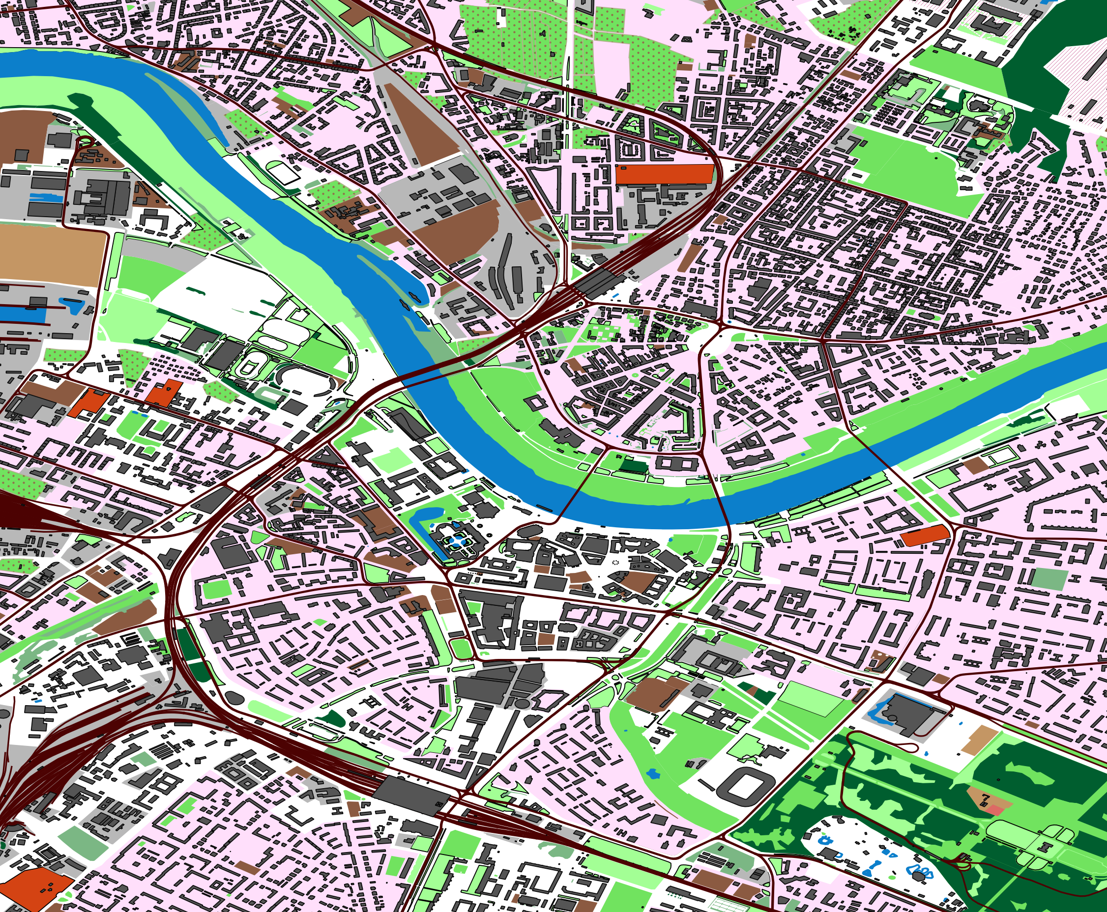
Dresden: landuse, buildings, railways.
Download: 34 MB; all layers.
Toulouse: streets, railways, waterways.
Download: 63 MB; all layers.
For graph processing (e.g. routing or reachability analysis with software like Network Analyst) we also offer special routable shapefiles which only include the road network. For these, OpenStreetMap data is preprocessed by splitting each road at each junction, so that the resulting shapefiles contain only road segments. The preprocessing step is slightly different for automobile, bicycle, or pedestrian routing. We can even add estimated travel times for each segment to the shapefile. Here is an example of such a routable shape file.
Geofabrik shapefiles are not mass-produced by some self-service machine. We
create them from current data according to your request, we do an error check,
and of course we're there for you if you have questions or problems after delivery.
You decide what you need:
What area – individual countries, continents, or the whole planet?
What kind of data – a thematic selection, or everything that OpenStreetMap has?
Which structure – are you happy with our standard, or do you have a fixed structure you want us to use?
Special requirements – maybe your shapefiles must not exceed a certain size, must have a special
character set, or be limited to a maximum number of features? Do you perhaps want simplified geometries, or names included
given in a specific language?
What frequency – do you want a one-off shipment or are you after automatic regular updates?
Geofabrik will charge a previously agreed fixed price for these services based on the amount of work involved. Please request a quotation if you are interested! As a guidance, a one-off full set of shapefiles will approximately cost:
| Area | Data Volume (est.) | Standard Shapefiles | Routable Shapefiles |
|---|---|---|---|
| city, county, small state | 1 GB | EUR 200 | EUR 300 |
| European country or group of countries | 5 GB | EUR 350 - EUR 500 | EUR 500 |
| whole continent | 30 GB | EUR 500 - EUR 1,000 | EUR 750 |
| whole world | 75 GB | EUR 1,800 | EUR 1,500 |
These rates are handling charges and not license fees – OpenStreetMap data is licensed under ODbL 1.0 which means that you can use it unrestricted, without having to pay a license fee.
In addition to the free and paid standard shape files, we have a range of special purpose shape files. Here's an overview.
Maybe you're wondering why we offer free shapefiles as well as a paid product.
The free shapefiles are produced daily in an automated process and we cannot
accommodate special requirements. Because we generate them daily and for large
parts of the world, we have to stick to a smaller selection of layers.
Nonetheless, these free shape
files are suitable for many applications – they contain the complete road network
and many POIs and areas. We're offering this free service to make OSM more widely
known and, in the long term, also get more people to join OSM. See section 7 of the
documentation
of the free shape files for a list of the differences between the free and the paid
shape files.
If you order paid shapefiles from us, you'll not only get more data in more layers (see OpenStreetMap Data in Layered GIS Format); we also have invested some time in making these shapefiles more easily usable in standard GIS systems. For example, where a POI is modeled as an area in OpenStreetMap, we will automatically generate a centre point geometry so you can process it just like any other POI. In situations where OSM uses more than one tag to describe the same thing, our shapefiles usually repair that as well.
And of course we can accommodate all sorts of special requests when doing custom shapefiles, for example regarding the features selected, their attributes, the categorisation into layers, or regional splitting. We can produce data in a form you can directly use.
Both our free and our paid shape files are generated from daily updated OpenStreetMap data and contain areas which are modelled as so-called multipolygons in OpenStreetMap.
At any time, Geofabrik has a complete copy of the OpenStreetMap database not older than a day or two. This means that we can always, even on short notice, produce current and complete extracts of OpenStreetMap data. Geofabrik team members are active project participants on a daily basis, and if anything changes in the project or there is a problem somewhere, then Geofabrik is among the first to know. Trust our experience – we know what we are doing.