
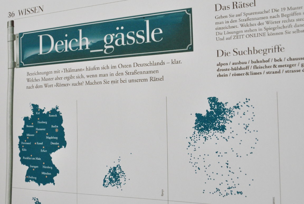
Geofabrik provided data for German weekly newspaper Die Zeit for the article Erst die Nazis, dann die Blümchen, (First the nazis, then the flowers) by Karsten Polke-Majewski and Sascha Venohr. This required calculating a list of all streets in Germany, with one entry per street with the following fields.
highway=* tag from OpenStreetMap), e.g. primary or residentialThe list was requested as a shape file and was generated using a few SQL queries against a PostgreSQL database with the PostGIS extension.
Streets are often not mapped as a single linestring in OpenStreetMap. They can be split into multiple linestrings because some attributes change along the road, e.g.: the number of lanes or the speed limit. These attributes were not needed for this project. Multiple linestrings were merged into a single (multi)linestring if they had the same name, alternative name, local name and old name and were located within 100 metres distance of each other. It was not suffient to only merge linestrings touching each other because streets are sometimes disconnected by intersecting streets or gaps, sometimes even intentional, sometimes by constructions.
All streets crossing municipal boundaries were splitted at the boundary.
You can explore the data interactively on Die Zeit's website
Our street lists are there to meet your requirements. We can add or remove additional columns as needed. Streets can be split at postal code and administrative boundaries. Coordinates can be in the spatial reference system of your choice. Many output formats are possible: Shapefiles, CSV files and also database dumps (PostgreSQL). You can download an example covering the German county "Hohenlohekreis" as a CSV file here.